Unlocking the Power of Earth Illustrations and 3D World Infographics for Adobe Photoshop
Introduction: The Visual Storytelling Revolution
In today's digital age, visual storytelling has become a cornerstone of effective communication. Whether you're crafting a presentation, designing a marketing campaign, or building educational materials, the right visuals can make all the difference. One of the most versatile tools for creating high-quality, customizable graphics is Adobe Photoshop, especially when paired with specialized assets like Earth illustrations and 3D world infographics. These resources empower designers, educators, and businesses to convey complex data in a visually compelling and easily digestible format.
What’s Inside the Earth Illustrations and 3D Infographics Product?
This comprehensive package includes a wide range of professionally designed assets tailored for use in Adobe Photoshop. Whether you're a seasoned graphic designer or a newcomer to the software, this toolkit offers everything you need to create stunning visuals that stand out.
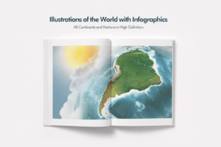
- 16 High-Resolution Landscape Illustrations of all continents and nations in a 16:9 aspect ratio, making them ideal for presentations, banners, and web graphics.
- Multiple Viewpoints available from both the Western and Eastern hemispheres, offering flexibility in visual perspective.
- Web-Optimized Size at 6000x3375 pixels (72 DPI, RGB), ensuring crisp visuals for digital platforms.
- Print-Ready Files at 20 x 11.25 inches (300 DPI, CMYK) for professional-quality prints.
- Layered Photoshop Files (.psd) with well-organized groups for maps, infographics, text, and background elements like sun and clouds.
- Customizable Infographics that allow users to tailor visuals to their specific needs, whether for business reports, educational content, or marketing materials.
- 100% Real 3D Maps generated from satellite imagery and official geographic references, ensuring accuracy and realism.
Why Earth Illustrations and 3D Infographics Matter
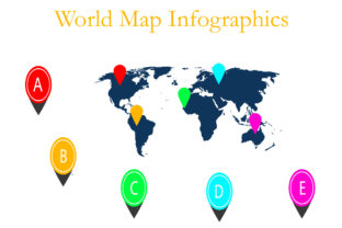
Visual data is processed by the human brain up to 60,000 times faster than text. That’s why infographics and illustrations are such powerful tools in modern communication. The Earth illustrations and 3D world infographics included in this package are not just aesthetically pleasing—they are also grounded in real-world data, making them ideal for a wide range of applications.
Accuracy Meets Artistry
Each illustration is based on real satellite imagery and official geographic data. This ensures that continents, nations, seas, oceans, islands, and even ice coverage are represented with scientific precision. Whether you're creating a geography lesson or a business report on global markets, these visuals offer a level of authenticity that generic graphics can't match.
Perfect for Diverse Use Cases
- Educators can use these visuals to make geography lessons more engaging and interactive.
- Business professionals can enhance presentations with accurate world maps and data visualizations.
- Marketers can create compelling campaigns that highlight global reach or regional focus.
- Designers can build custom graphics for websites, social media, or print materials using a consistent, high-quality visual style.
How to Use These Assets in Adobe Photoshop
One of the standout features of this product is its compatibility with Adobe Photoshop. The .psd files are designed to work seamlessly with versions from CS4 to CC 2018, regardless of the language setting. This makes them accessible to a global audience of designers and creators.
Layered Design for Maximum Flexibility
Each file is meticulously organized into layers and groups, including separate sections for:
- Graphics (sun, clouds, and other visual elements)
- Maps (continents, countries, and geographic features)
- Infographics (charts, icons, and data representations)
- Text (labels, titles, and annotations)
This structure allows users to easily edit, hide, or rearrange elements without affecting the rest of the design. Whether you want to highlight a specific region or overlay custom data, the layered format makes customization straightforward.
Exporting for Web or Print Made Simple
Once your design is complete, you can export it for both digital and print use. The web-optimized version ensures fast loading times and crisp display on screens, while the print-ready files guarantee high-quality output for brochures, posters, and presentations.
Real-World Applications and Benefits
Let’s explore some practical examples of how these Earth illustrations and 3D infographics can be used across different industries and disciplines.
Education: Making Geography Come Alive
Imagine teaching students about the continents using a realistic 3D map that they can interact with visually. These illustrations can be used in digital textbooks, classroom posters, or interactive learning modules. Teachers can highlight specific regions, add annotations, or overlay data such as population density or climate zones.
Marketing: Visualizing Global Reach
For businesses that operate internationally, showcasing their global presence is crucial. These illustrations can be used in annual reports, investor presentations, or website banners to visually represent the company’s reach across continents and countries. Customizable infographics can also highlight key metrics such as revenue by region or customer demographics.
Environmental Science: Tracking Change Over Time
Environmental researchers and activists can use these visuals to illustrate changes in ice coverage, deforestation, or ocean temperatures over time. By overlaying data onto realistic 3D maps, they can create compelling visuals that communicate the urgency of climate change and other environmental issues.
Travel and Tourism: Inspiring Exploration
Travel agencies, bloggers, and tourism boards can use these illustrations to create visually appealing content that showcases destinations. Whether it's highlighting popular travel routes, cultural landmarks, or natural wonders, these visuals can help inspire wanderlust and drive engagement.
Common Misconceptions and Clarifications
While many people assume that all map illustrations are created equal, the reality is that the quality, accuracy, and usability of these assets can vary significantly. Here are a few common misconceptions about Earth illustrations and 3D infographics:
- Misconception: All map illustrations are based on accurate data.
Reality: Many generic graphics are stylized or outdated. This product uses satellite imagery and official references to ensure accuracy. - Misconception: Photoshop files are difficult to customize.
Reality: With organized layers and groups, even beginners can make meaningful edits using basic Photoshop tools. - Misconception: High-resolution files are only for print.
Reality: The included web-optimized versions are ideal for digital use, ensuring fast load times without sacrificing quality.
Conclusion: Elevating Your Visual Content with Earth Illustrations and 3D Infographics
In a world where attention spans are short and information overload is common, the ability to communicate clearly and effectively through visuals is more important than ever. The Earth illustrations and 3D world infographics included in this Photoshop package offer a powerful way to enhance your content, whether you're an educator, marketer, designer, or researcher.
With their high-resolution detail, accurate geographic representation, and flexible customization options, these assets provide a solid foundation for creating professional-quality visuals. From classroom presentations to corporate reports, from travel blogs to environmental campaigns, the possibilities are virtually endless.
By investing in a toolkit that combines artistic quality with scientific accuracy, you're not just enhancing your designs—you're also ensuring that your message is communicated with clarity, credibility, and impact.
Ready to take your visual storytelling to the next level? Explore the full potential of Earth illustrations and 3D world infographics today and see how they can transform your creative projects.